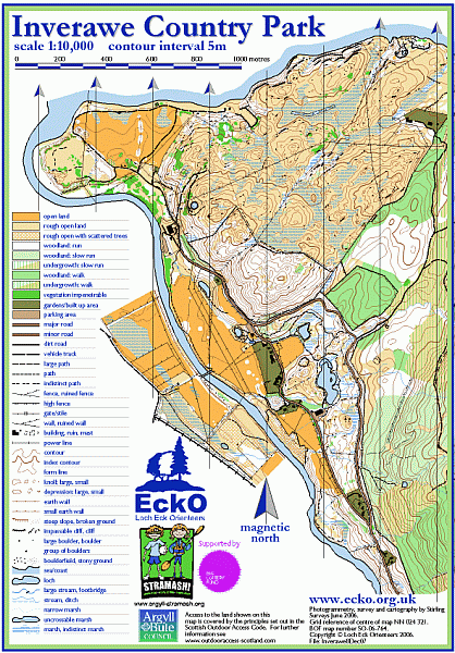
Inverawe map
Information
An area of many terrain types which is bordered by plantation forestry to the east.
An intricate path network in the south around the ponds and through the surrounding broadleaved woodland. To the north the land rises steeply over a broadleaved-covered hillside which opens onto contoured, tussocky moorland where it is easy to make parallel mistakes. Clumps of gorse bushes reduce visibility at times.

