
Glenbranter map
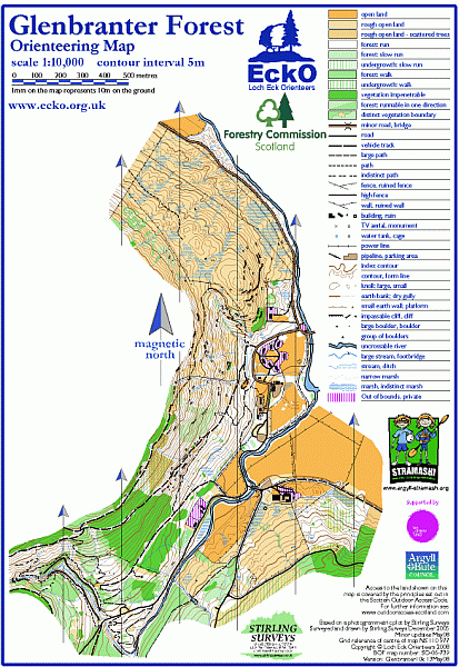
Glenbranter
Information
A steep hillside covered with varying ages of plantation forestry. Bracken in felled areas.
The forestry area is being developed for recreation with paths being added for walking and mountain biking. The rough open area to the north is grazed by cattle.
Permanent Course available.