| Map name | Near | Info | Map |
|---|---|---|---|
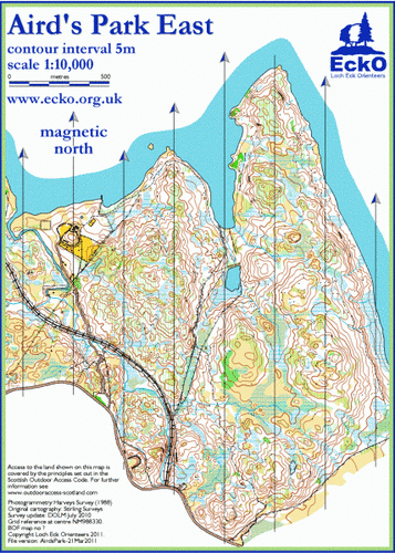
| Aird’s Park East | Taynuilt | The detailed contours in this undulating area give excellent challenges at TD 4 and TD 5. The broadleaved woodland is a mixture of mature oak and younger birch thickets. This area is at its best in the spring. |
|
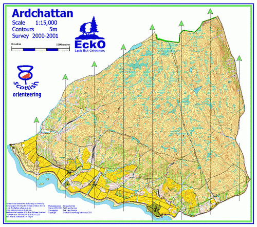
| Ardchattan | Oban | This extensive area on the north shores of Loch Etive is mainly open hillside with good contour detail. |
|
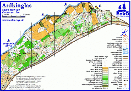
| Ardkinglas | Cairndow | This area is a hill slope on the east side of upper Loch Fyne and is part of the Ardkinglas Estate. |
|
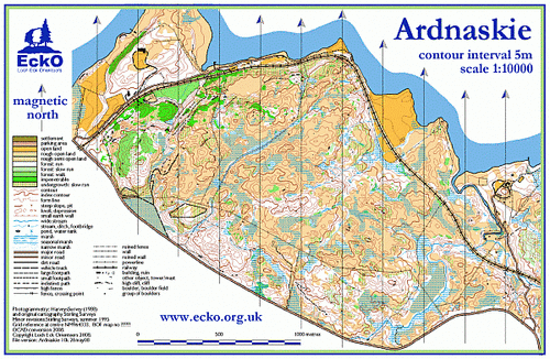
| Ardnaskie | Taynuilt | The detailed contours in this undulating area give excellent challenges at TD 4 and TD 5. |
|
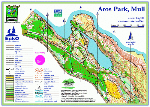
| Aros Park, Mull | Tobermory mull | TBA |
|
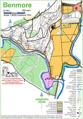
| Benmore Gardens | Dunoon | Botanical Gardens with intricate path network |
|
| Bishops Glen | Dunoon | The former reservoir area for Dunoon has a network of paths which are well-used by local people. The hillside is covered with commercial plantation which is generally thick. |

|
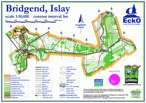
| Bridgend, Islay | Bridgend, Islay | TBA |
|
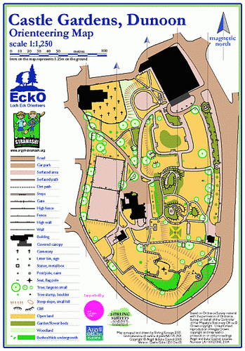
| Castle Gardens | Dunoon | A ‘thumbnail’ area in Dunoon. Careful navigation is required to quickly and successfully complete courses as visibility is varied. |
|
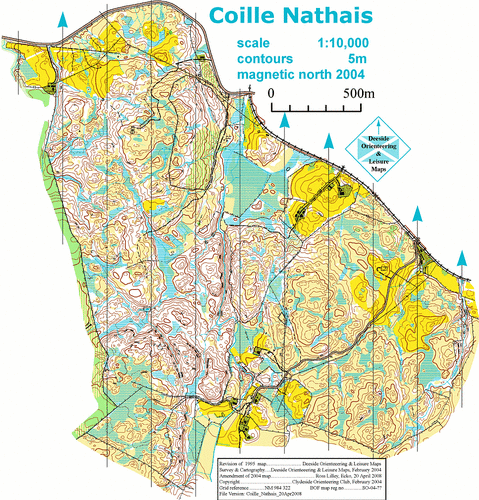
| Coille Nathais | Taynuilt |
|
|
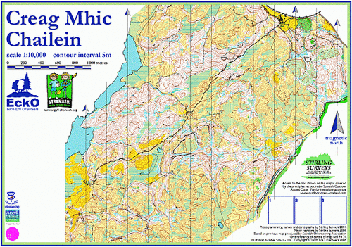
| Creag Mhic Chailein | Connel | Mainly broadleaved woodland, interspersed with open areas; areas of marsh aid navigation. |
|
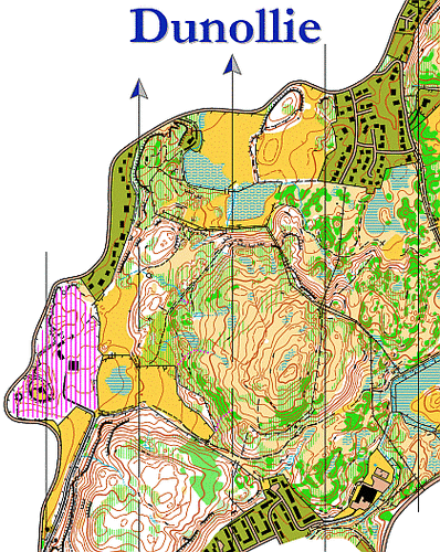
| Dunollie | Oban | The hilly, mostly rough open area between Dunollie and Ganavan |
|
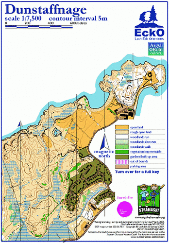
| Dunstaffnage | Dunbeg | A great area for short courses, especially around Dunstaffnage Castle, where it is contained by natural boundaries and yet has relatively low visibility in summer. |
|
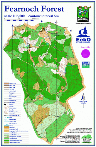
| Fearnoch | Taynuilt | A large area of commercial plantation with a network of forest roads. Map is path and off-path. The area is most suited to courses up to TD 3 (including Long Orange) and bike-O |
|
| Ganavan | Oban | Ganavan comprises rough open heather/grassy moorland rising behind Ganavan beach and north towards Dunstaffnage and Dunbeg. |

|
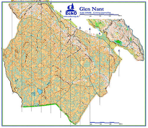
| Glen Nant | Taynuilt | EckO’s latest map |
|
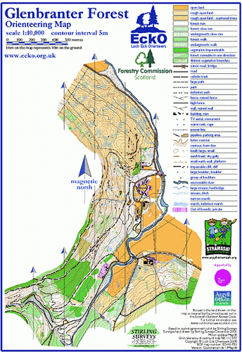
| Glenbranter | Strachur | A steep hillside covered with varying ages of plantation forestry. Bracken in felled areas. |
|
| Glencoe Lochan |
|
||
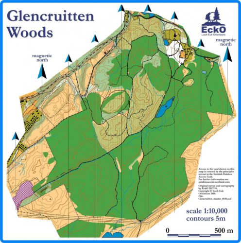
| Glencruitten Woods | Oban | A spruce plantation with network of paths and tracks on edge of Oban |
|
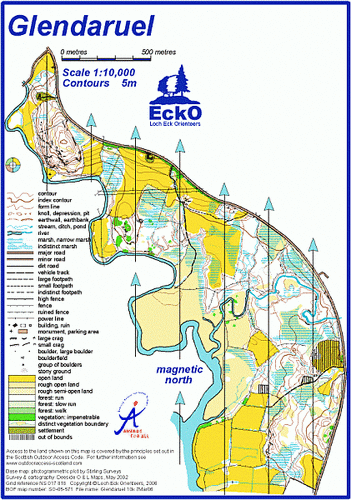
| Glendaruel | Glendaruel | An area of farmland (pasture) and birch trees sandwiched between the road and the river. Marshes can be treacherous if the river has recently flooded. |
|
| Glendaruel Caravan Park | Glendaruel | Glendaruel Caravan Park is an ideal area to introduce the complexities of map-reading to beginners. In winter there is less undergrowth and visibility is increased. |

|
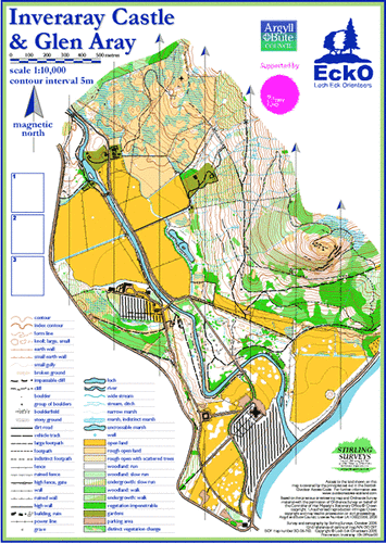
| Inveraray | Inveraray | The mapped area has a variety of terrain. Around Inveraray Castle the land is flat with fields for grazing. On the lower slopes of Dun na Cuaiche there is an extensive network of paths amongst broadleaf woodland. |
|
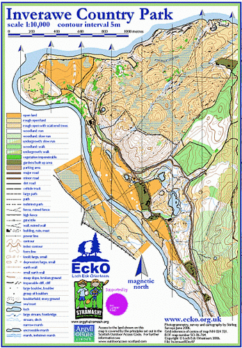
| Inverawe | Taynuilt | An area of many terrain types which is bordered by plantation forestry to the east. |
|
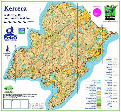
| Kerrera | Oban | An exciting area on an island just SW of Oban. Open moorland running with interesting contour detail supported by patches of intricate rock features. |
|
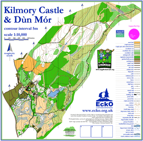
| Kilmory Castle | Lochgilphead | Detailed mapping in the south around the loch and the house where there is a detailed network of paths and runnable areas. |
|
| Kilmun | Dunoon | A deceptively steep hillside with a network of paths criss-crossing it. |

|
| Loch Nell and Shenavallie | Benderloch | This is a coastal peninsula typical of the west coast of Scotland with a rocky shoreline and several inlets. The area is mainly flat with raised areas of natural mixed woodland. |
|
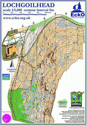
| Lochgoilhead | Lochgoilhead | A steep, tussocky and marshy hillside above the village of Lochgoilhead. The many large crags require careful navigation. |
|
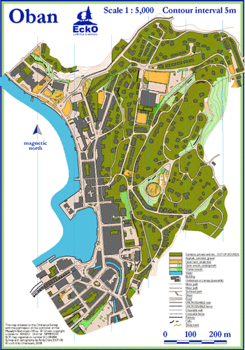
| Oban | Oban | A 1:5000 street map of part of the town which includes the hill with McCaig’s Tower on the top. |
|
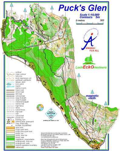
| Puck’s Glen | Dunoon | A steep hillside, mainly covered with thick plantation sitka spruce, runs along the west edge of the area. |
|
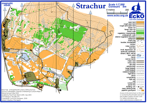
| Strachur | Strachur | This map divides into two separate areas: the open hillside is tussocky (quite heavy going, especially if there has been a lot of rain!). |
|
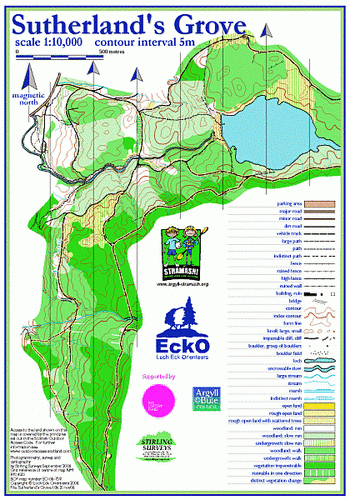
| Sutherland’s Grove | Barcaldine | Path and ‘off-path’ map. Mainly plantation forest of varying age. Area is most suitable for up to TD3 courses (including Red) and bike-O. |
|
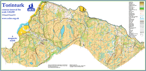
| Torinturk | Taynuilt | Mostly an open runnable hillside with intricate boulder and crag detail. |
|
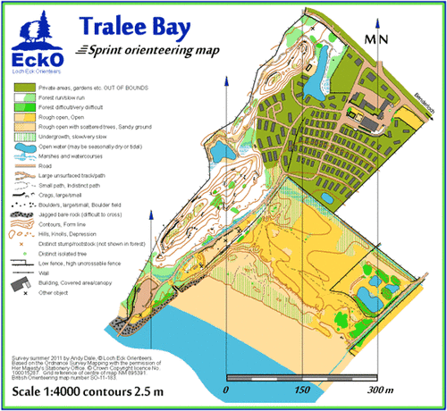
| Tralee Bay | Benderloch | Mixture of fast, mature woodland, beach, dunes and caravan park. 1:5000 sprint map (ISSOM) with 2.5m contours. |
|

Mapped Areas
All the areas we have mapped for orienteering. Select a flag to show its details.
Note: Possession or existence of a map does not imply right of access for orienteering or for any other purpose. Permission must be obtained from the landowner.