
Inveraray map
Inveraray
Information
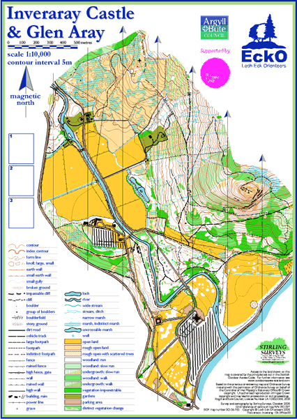
The mapped area has a variety of terrain. Around Inveraray Castle the land is flat with fields for grazing. On the lower slopes of Dun na Cuaiche there is an extensive network of paths amongst broadleaf woodland.
There is also a lot of historical interest with the remains of a ‘camp’ from WW2 and an old lime kiln. Further north, and also higher up the hill, the woodland gives way to coniferous plantation. The slopes are steeper and care is required if underfoot conditions are wet. The northern edge of the map is rough open hillside which is grazed by cattle and sheep; as this area is quite wet, the underfoot conditions are broken and marshy.